Luxury Fashion & Timeless Accessories
Luxury Fashion & Timeless Accessories Luxury Fashion & Timeless Accessories
Home Outdoor Gear Tools
Rooftop's Jamieson Licola Adventure Map camp map guide sale waterproof hiking map topographic camping map

Rooftop's Jamieson Licola Adventure Map

$ 20.00

$ 80.00

Unavailable
Rooftop's Jamieson Licola Adventure Map camp map guide sale waterproof hiking map topographic camping map

Rooftop's Jamieson Licola Adventure Map

$ 20.00

$ 80.00

Unavailable
Please select combo product attributes
The combo subtotal is $,SAVE$

Product Details

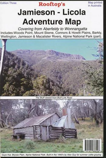
Explore the Upper Goulburn, Jamieson & Licola region as you've never seen it before.

Map coverage is from Goughs Bay, Jamieson and the Howqua River in the north to the Upper Thomson, Aberfeldy and Licola in the south. It includes Woods Point, Mount Skene, Alpine National Park, Wellington, Jamieson, Macalister and Thomson Rivers, Connors and Howitt Plains.. Scale is 1:100,000.

The reverse of the map has a 1:50,000 scale enlargement titled 'Sheepyard Flat - Caledonia Valley Forest Activities Map' with contours.

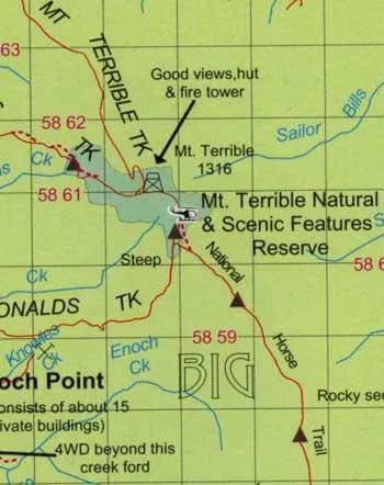
All parks, reserves and state forests are shown and all roads and tracks have been plotted using GPS mapping technology.

You May Also Like

Cart
Luxury Fashion & Timeless Accessories
Your cart is currently empty.